Integrated Modelling of Socio-environmental Transitions (IMOSET)
|
Data and Resources
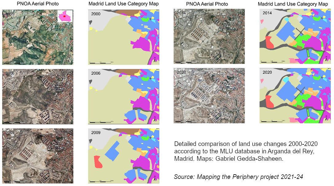
On this page data and resources generated by the group will be periodically posted, including conference presentations, open source data manipulated or analysed by various projects and outputs, and links to teaching materials, videos and social media. Mapping the Periphery In the "Mapping the Periphery" project we developed a large detail scale Land Use Land Cover (LULC) geodatabase focused on urban land uses in the entire Madrid region. The current phase of the project consisted of updating Madrid's land use data for the years 2014 and 2020, using various data sources, including historical aerial photos from the National Aerial Orthophotography Plan (PNOA), Google Labels and Google Street View. The complete database, called Madrid Land Use is now available for download under a creative commons 4.0 license.
|
 |
 |
 |
 |
 |
 |
 |
